(Source: China Daily)
Ningxia and its close relationship with Yellow River
By Bruce Connolly | chinadaily.com.cn | Updated: 2018-07-20 06:50
In 1987, on my first rail journey south through China as the train neared Zhengzhou, I was awakened by my fellow passengers pointing out the window. "Yellow River", they were exclaiming. It was a stunning early morning sunrise and I could see by their reaction how they held its waters in awe.
Throughout history it has been both a source and destroyer of life, known at times as 'China's Sorrow' due to the floods that could deliver havoc. It seemed incredible to think that the Yellow River (Huanghe) was first being "tamed to conserve its waters" as early as the Second Millennium BC. Rising high on the Qinghai-Tibet Plateau, for much of the first half of a 5,000 kilometer journey to the Bohai Gulf, it passes across lightly populated terrain of high altitude grasslands, deserts and the loess lands of the 'Yellow Earth". Indeed it also flows through nine provinces and autonomous regions.
The river has been symbolized in Chinese mythology as a dragon crossing the country's historic heartland, the cradle of civilization that nurtured several of the nation's great dynasties. For over 5,000 years people have settled by its banks, growing crops, fishing, producing pottery. Indeed my own travels in northwestern China have shown often the only areas where people could live were close to the river itself. Its often murky waters facilitated cultivation and in effect were the lifeblood of the people.
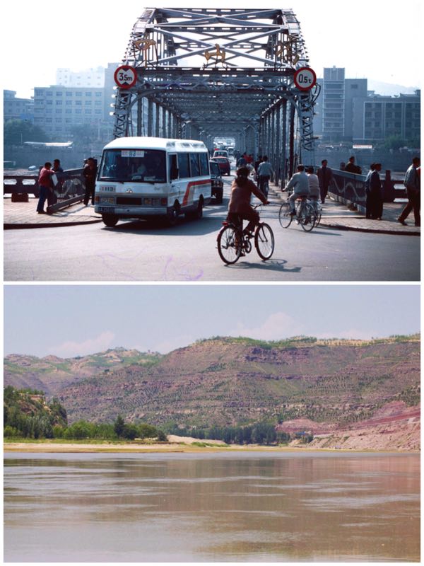
In my travels, I have been fortunate to come upon the Yellow River in various stages along its course. Most recently it was from a high-speed train heading to Xi'an passing a lake backed up behind the dam at Sanmenxia. However, go back to 1996 when I had come by train from Xining in Qinghai to Lanzhou. Standing at that city's iconic Zhongshan Bridge I looked at the river as it flowed beyond and wondered why it did not continue directly eastwards toward Xi'an. Instead it turns northeast, heading on a colossal journey right up to Inner Mongolia before reversing south on its long push toward Sanmenxia. The answer lies partly in geology with mountains east of Lanzhou, but this extensive loop, the greatest of the Yellow River's nine bends has allowed a band of life through a quite hostile, dry environment up to and through Ningxia (Ningxia Hui Autonomous Region) where I was heading in 1997.
Looking at the river from today's satellite imagery it is fascinating to follow its course, seeing how, for example, it forms the lengthy border between Shaanxi and Shanxi provinces. Two years ago was another memorable personal moment standing on its shores at Shanxi's Qikou village while recalling how hydrological science started to develop along the river more than 4,000 years previously - a science still very relevant today in controlling and taming its sometimes perilous nature.
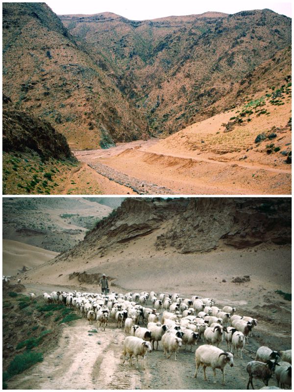
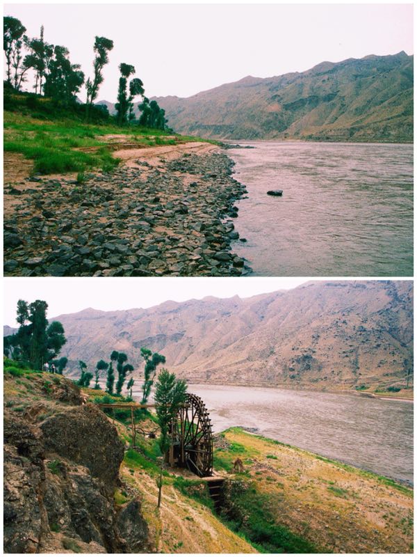
Highway G2012 enters northwestern Ningxia along a narrow corridor of land between Inner Mongolia to the north and Gansu to the south. The terrain mostly gravelly or sandy desert, population almost non-existent. The road lies well back from the Yellow River where sheer physical geography would make highway construction almost impossible. At an isolated junction a sign pointed south to Yiwanquancun. The jeep I was in veered onto a gravel, rocky track only passable at that time by strong 4-wheel drive SUVs. Flocks of sheep and goats were herded along the track but for over an hour descending deeper and deeper down an often steep-sided ravine, at times following narrow ledges, no other vehicles passed. An isolated house, possibly of a shepherd, was the only sign of settlement.
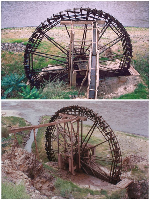
The route followed a dry river valley gradually opening out to patches of irrigated cultivation. We were approaching Beichangtan, an adobe-walled village sitting above an earthen river cliff enclosed within a steep-sided canyon where the Yellow River pushed through. On the far bank was a crumbling section of the Great Wall. It was near that village that I was to see one of the last operational wooden water wheels along the Yellow River. Such devices have operated since the Han Dynasty, lifting water from channels feeding from the river, passing the flow into higher aqueducts feeding towards the fields. Without such intermediate technology life along the valley would have been virtually impossible. Today mechanized pumps mostly transfer the waters.
Before recent bridge building the river effectively kept communities apart - indeed horsemen would dismount, encourage their animals into the water with the rider then holding the tail and be pulled across to the far bank! At Shapatou I experienced another way of crossing the flow - the traditional "yangpi fazi" or sheepskin rafts! At first it looked frail - a frame of thin wooden sticks laid across inflated sheepskin hides. The skins are prepared with the fleece turned inside out, it is then tightly sealed and coated with oil to increase waterproofing. For hundreds of kilometers along the river for many communities this was often their only feasible crossing. Indeed they also played a key role in the Silk Road - even into the 1950s many rafts were lashed together to carry freight 2000 kilometers from Lanzhou to Baotou in Inner Mongolia from where camel caravans and later a railway connected to Beijing. The largest rafts would be up to 600 skins and could carry 30 tons of cargo.
Today the users are tourists for modern infrastructure including bridge building has rendered most of this downriver traffic redundant. At Shapatou I "sailed" on one with 14 inflated skins. As the boatman gently guided this little vessel across the current, after some initial apprehensions, I lay back, listened to the sounds of the water and thought of scene when flotillas of these little rafts historically would crowd stretches of the river, such as where I was floating.
Reaching Shapatou village and the river banks was one of those great "child-like" experiences for although a road led down from Provincial Highway 201 I opted to walk or more precisely jump down the sand slopes with great whoops of joy at every leap!
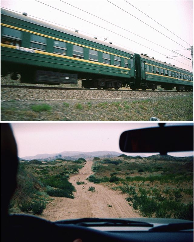
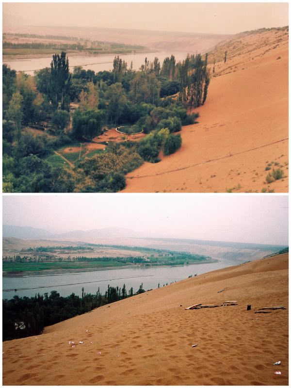
It was the coming of the railway that saw an end to the rafts for Shapatou was set to be at the heart of one of China's great railway engineering achievements. The main highway skirts along the crest of sand hills above a great meander on the Yellow River. Parallel is the railway from Baotou to Lanzhou. In the 1950's railway building was essential for unifying a country as vast as China. However the terrain at Shapatou was initially viewed as impossible for such construction as this is where the vast dunes of the Tengger Desert encroached right up to the river. Somehow the railway after following the wide, flat valley from Yinchuan to Zhongwei had to go up and over the sands. Sand, of course, could easily be blown across the tracks. In 1956 the Shapatou Desert Research Centre was established. Their resulting solution was to dig small squares of straw into the dunes with drought resistant bushes being incorporated into the resultant chequer board pattern. A slow process but eventually several thousand hectares of moving sand was reclaimed creating a long green passageway for the railway. A few kilometers west of Shapatou the tracks climbs in a series of great horseshoe bends, a magnificent sight in the days of steam hauled trains with smoke belching as they wound their way up the slopes.

I walked beyond into the emptiness of the desert, with its feeling of silence, of lifelessness - the terrain stretching before me, one of the emptiest places on earth, the desolate, waterless Tengger. To the north, only 20 kilometers away was Inner Mongolia but there were no roads leading across this dry, hostile terrain.
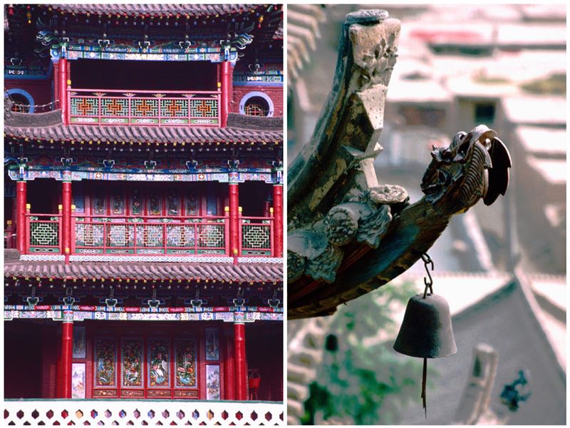
Beyond Shapatou, Zhongwei is the first major town on the western route into Ningxia. Focused around a highly ornate drum tower is was a pleasant, friendly place to be based with its fascinating mix of street life centered around small outdoor markets. People went around by bicycle. Incredibly I came upon locals playing a game of 19th century French-inspired croquet! Alongside the Yellow River, Zhongwei was in many ways an oasis town, it acted as a gateway to or from the Northern Silk Road crossing the previously mentioned barren deserts stretching to Gansu. Its main delight for me was the incredibly intricate Gao Miao Temple, a functional complex serving Buddhism, Confucianism and Taoism. Dating back to the Ming Dynasty, it was rebuilt several times due to earthquake or fire damage. Today's temple was reconstructed in 1947. Appearing at first one building there are actually 250 temple rooms, towers and pavilions feeling somewhat like a dreamland castle!
Heading northeast, the Yellow River valley widens and is increasingly arable due to a series of large irrigation canals, some dating back to the Han Dynasty (206 BC-220 AD). Over time the network has been expanded, carefully using river water both for agriculture and power generation. In this role Qingtongxia Dam, constructed in 1962, has transformed part of the river into a long lake. Boats transferred visitors across the waters to one of Ningxia's prime historic sites, the 108 Dagobas (qingtongxia yibai ling ba ta) dating from the Yuan Dynasty. From the pier alongside irrigated rice fields a path leads across to a steeply rising hillside. There, in twelve decreasing rows, resembling a triangular constellation, stretch the small dagobas. The structure is crowned by a singular large one in front of a compact temple containing clay Buddhist figurines. From the summit stretched a panoramic view of the river. With intensive agriculture along its banks, beyond lay the superstructure of the hydro dam. I sat there for a while, looking out and thinking of the role played by this section of the Yellow River, a river so pivotal in the story of today's China.