(Source: China Daily)
Ningxia, a region of fascinating physical, human and historic diversity
By Bruce Connolly | chinadaily.com.cn | Updated: 2018-08-13 17:10
In 1997 a personal ambition was to travel overland from Beijing right across northwestern China. Part of that dream was to visit Ningxia, or more correctly Ningxia Hui autonomous region, reflecting its sizable Hui Muslim population.
In a previous article I had discussed the relationship between Ningxia and the Yellow River, how without the waters it would be desert. Ningxia is described as "lush southern-style fields north of the Great Wall". The river water facilitated intensive irrigation of surrounding plains since the Han Dynasty (206 BC to 220 AD).
Surrounded by deserts, the valley provided a relatively safe Silk Road corridor, at times using the river up to Baotou, in Inner Mongolia. Later it would carry the railway around the western part of the Yellow River's "Great Bend" through to Lanzhou in Gansu. It was from Baotou in 1997 that I traveled by train to Ningxia's capital city, Yinchuan. Its name translates as "Silvery River" due to deposits of salt left behind after periodic floods.
A history going back at least over 2,000 years, it was capital of the Western Xia Dynasty (1038-1644) and since 1958 capital of Ningxia. I was staying in the older area of Yinchuan. Being compact in size and having several remains of its former walls and gates still standing it felt an attractive city and great for walking around. A good place to start was the Regional Museum, surrounded by delightful gardens it helped provide an insight into the history and culture of Ningxia.
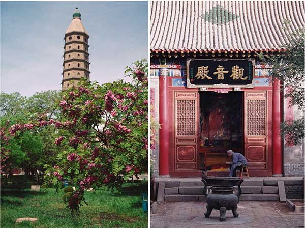
Near my hotel the North Pagoda rising above the Haibao Tasi Temple looked enticing. Climbing to its 13th floor provide me panoramic views across nearby rice fields toward the modern skyline of the city. Like in many historic city centers, a three-story Drum Tower (gulou)rose from an uplifted brick base and surrounded by four smaller towers. A short walk led to the city's main square and its famed South Gate (nanmen lou)known as the local Tiananmen due to similarities with Beijing's much larger structure. Serving its sizeable Hui, or Muslim population, Yinchuan has many often beautiful mosques. I visited the Nanguan Mosque, a spacious structure with two tall minarets, set within tranquil gardens enhanced by cooling fountains.
Around parts of the older areas such as Zhongshan Nanjie were crowded with food stalls. Skewers of lamb or local Yellow River carp fish were grilled over charcoal with red ground spices or curry powder sprinkled over them. The aroma enticing me to order up copious portions washed down with cold local beer. Yinchuan's dining experiences were enhanced through many local products including wolfberry, sand onions (sha cong)and tasty mustard on shredded vegetables called "Lovers Tears" - which certainly brought tears to my eyes.

Beyond the northern edge of the city and bordering on sand dunes is a small oasis, Shahu or "Sand Lake", apparently formed when an irrigation canal seeped into the desert. Access across the waters was by fast speedboats zipping through clumpy reed marshes, home to around 200 different bird species, followed by open water to the foot of the dunes. While camels or a chairlift could carry visitors uphill I preferred walking to experience how tough climbing sand could be. From the top I looked across a landscape of rolling dunes, the desert. With many sand-related activities for visitors, holding on tightly, I tried dune sledging!
From the sand lake a road heads across a gravelly plain toward the majestic Helan Mountains that shelters Yinchuan from the the Tengger Desert. The mountains produce the "Fifth Treasure of Ningxia", stone for China's finest ink blocks - an essential element in calligraphy.
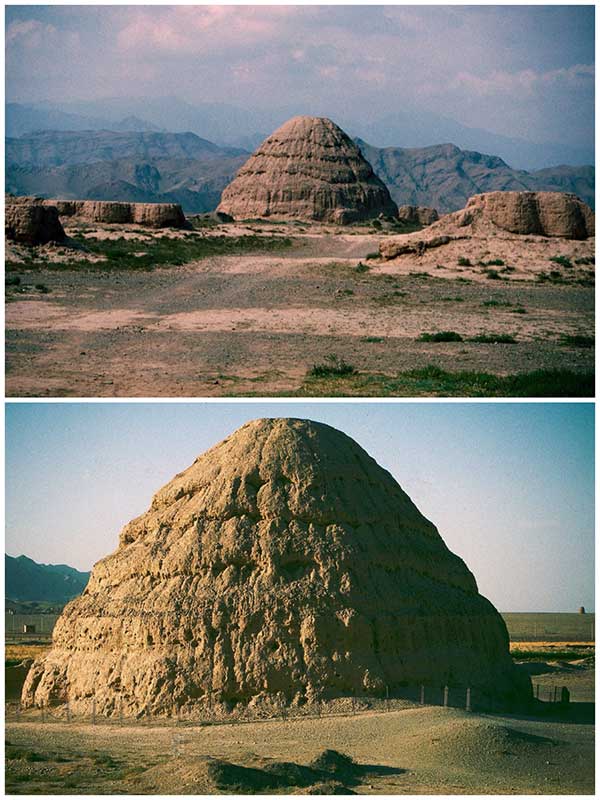
The aridity restricting human activity away from the Yellow River has helped preserve unique reminders of regional antiquity. Along the base of the mountains lies the weathered remains of pyramids, the Western Xia Mausoleum (xixia wang ling). Tombs from the kingdom of the Western Xia based around the Yinchuan area from 1038 to 1227. Referred to as "A Mythical Kingdom on the Silk Road" it succumbed to Genghis Khan's military advances leaving little trace except the tombs along with the name Ningxia or "Peaceful Xia". The site bears a resemblance to Egyptian pyramids, not in size but in mysteries and hints of long-gone civilizations. Covering around 40 square kilometers the mounds, some crumbling, but varying in size appeared partly surrounded by mud wall fortifications.
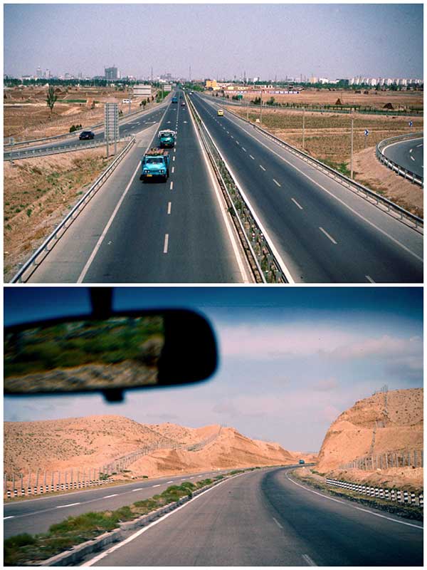
In 1997 a new expressway led out of Yinchuan, crossing the Yellow River and into an increasingly arid environment. Reaching a plateau, we turned left onto a gravel road descending into a steep sided valley before crossing a shallow river. Getting out the jeep I started walking toward what at first resembled a cliff. Scrambling up its steep sides I soon found myself standing on what had once been a beacon tower atop the Great Wall. Maps show considerable stretches of the Wall crisscrossing parts of Ningxia - after all this was historically a strategic area defending against invasion from the north and west. Indeed the sections within today's Ningxia measured up to 1,507 kilometers of which only 518 kilometers remain. Construction was mostly rammed earth which over time suffered the ravages of weather and human activities. Often in remote locations it was difficult to protect. From my vantage point, I looked across the wastes of the western extent of the Ordos Desert toward Inner Mongolia. There appeared no habitation with often only the scantiest hint of vegetation along the watered valley I had crossed. Sitting there I thought of the sheer discomfort of the soldiers manning the Wall particularly during sand storms such as I encountered on a later visit.
Yinchuan was comfortable but from the city I would head west along the Yellow River valley to Yongning before turning south to reach a geographically different Ningxia.
An increasingly hilly area marked the beginning of the Liupan Mountains. Much of the land appeared terraced for farming. Despite unseasonal grey and damp weather the area was significantly greener and held a greater biodiversity than much of the region I had previously travelled through. The mountains where the Wei river rises separated the northern lightly populated nomadic lands from the more settled agricultural lands that eventually spread toward the East China Plain. Highway S101 led toward the historic prefecture-level city of Guyuan. Sitting in a strategic pass on a former eastern branch of the fabled Silk Road it historically had a strong military importance. Reaching its zenith during the Mong Dynasty Guyuan controlled a route connecting central Shaanxi to the western lands beyond the Great Wall.

Staying in Guyuan, I had the opportunity to wander through its night markets, sitting at food stalls and watching local life. A morning visit to the city's museum revealed a large model of Guyuan during the Qing Dynasty. The city had been surrounded by two sets of walls that included 10 major gate towers. Far from the main Silk Route from Lanzhou to Xi'an Guyuan gradually became isolated physically and economically. However, the completion of the Baoji-Zhongwei Railway in the late 1990s, opening of an airport in 2010 and expressway construction has considerably improved connectivity.
Leaving Guyuan, heading back north passing many agricultural communities, former mud-walled towns and a section of the Qin Dynasty Great Wall, after 40 kilometers the road reached Sanying. A narrow highway then led west into the mountains where shepherds walked flocks of sheep and goats. At times the road was perched above the shallow waters of the Choushuihe River as it wound its way through a red sandstone gorge. After 40 kilometers we pulled up at the Xumi Shan Grottoes. The name coming from the Sanskrit "sumeru" or "treasure mountain". Among the 10 most famous grottoes in China they date from the Northern Wei (386-534), having been enlarged several times since. Dug and built along and into the contours of the mountains there are around 150 caves.
A path wound above a river-cut ravine to a 22 meter high Buddha, Dafo Lou, carved into the rusty-red sandstone cliffs. A long flight of steps led up to this towering and imposing statue. Beyond, a series of steep, narrow walkways cut directly into the rock headed up the cliffs. These led to dozens of man-made caves containing smaller Buddhist statues and shrines where incense sticks were placed. Along the trail, decorative tings or pavilions provided welcome resting places as I worked up to the top of one long section. The extensive, panoramic view across the reddish-colored landscape was worth the effort. Around me narrow ledges and paths headed off in every direction to more caves and even a small Tang Dynasty temple where nuns holding bundles of incense sticks quietly chanted. It would have been easy to spend an entire day on Xumi Shan but lunch of noodles and beef in a local Muslim restaurant was waiting back at Sanying town.

Back on the road, the weather started clearing and soon we were contouring through attractive rolling countryside. Former beacon towers rose from surrounding hills. The landscape was changing, the land drier and not so green as we passed villages of mud-brick walled flat roofed homes. Cattle stood in adjoining stalls, chickens scavenged for food while ducks lazily paddled in small fish ponds. Meanwhile, farmers filled sacks with winnowed grain to be loaded onto tractor-hauled carts.
By the time Tongxin county was reached the land was much drier. Drought had been a periodic problem for this primarily agricultural area. In recent years high-technology farming methods have been introduced to help improve output and living standards.
The majority of Tongxin's population is Hui Muslim, many descendants of earlier Silk Road traders who intermarried and settled locally. On a hill overlooking the town rose the Tongxin Great Mosque. Composed mainly of bricks and brown wood it resembled a large temple in design but on closer inspection combined elements of Hui and Han culture - an architectural feature I had seen of many mosques across northwestern China. Then the largest and oldest mosque in Ningxia, it was built during the Ming Dynasty (1368-1644).

It was a Friday afternoon, a service was underway, shoes neatly placed outside the main, carpeted hall. As it finished, men wearing distinctive white circular caps emerged, getting on their bicycles and heading off to surrounding villages - some waving and shouting "Hello" to me. Beyond I looked across the surrounding landscape dotted with small villages. Sheep, watched over by two young boys, grazed near me.
Back on the highway, heading toward the Yellow River bridge at Zhongning, the weather was turning bright and sunny but away from the waters of the river, the land increasingly arid. Irrigation became essential for cultivation of rice and vegetables. The road headed northeast along the valley towards Yinchuan. After the quiet villages of southern Ningxia, the regional capital had a more cosmopolitan feel. That evening walking around the central area it was easy to understand why it was referred to as one of China's more pleasant cities.