(Source: China Daily)
Hohhot, Inner Mongolia's 'blue Sky City'
By Bruce Connolly | chinadaily.com.cn | Updated: 2018-09-13 08:45
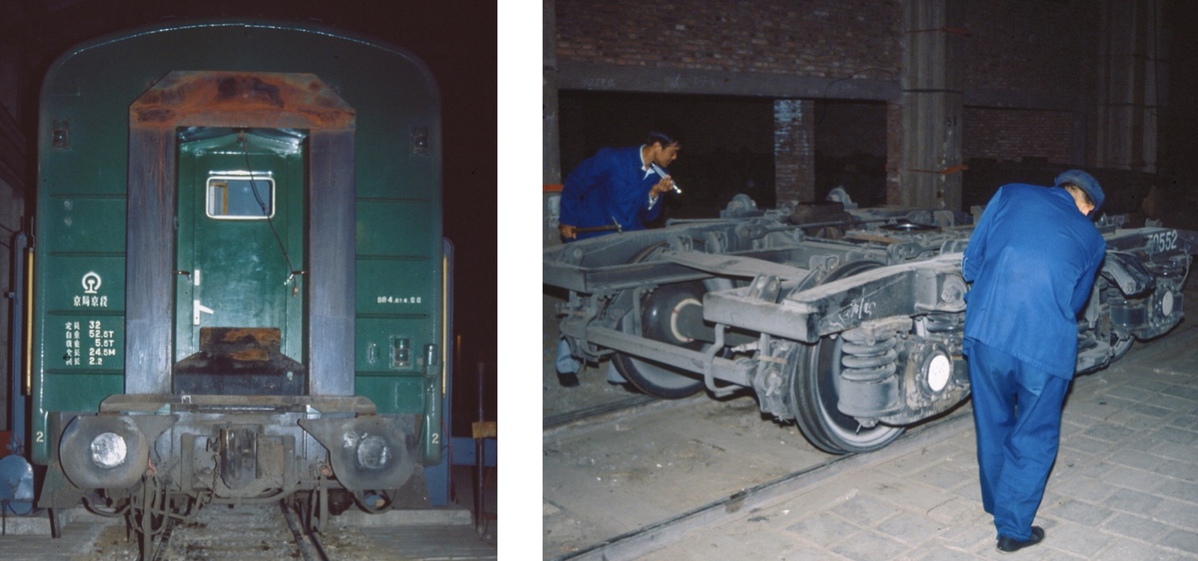
In China, a nation encompassing several of the world's largest cities, my first footprint was at Erenhot, a desert town of under 8,000 people. It was July 1987. I had crossed the border by train, which had halted at Erenhot for almost three hours, not just for entry formalities but also for "changing the wheels"! Mongolia's rail lines are 1.52 mm wide compared to China's 1.43 mm standard gauge. My first memorable China moment was being invited underneath the train to observe the bogies being manually swapped. Departing toward Beijing after midnight I unfortunately saw nothing of the onward journey through Inner Mongolia before reaching Datong in Shanxi.

Ten years later I would return by train to the capital city of Inner Mongolia autonomous region, Hohhot. Its name literally meaning "Blue Sky City" stands for the whole region indeed, as my experiences would show, Inner Mongolia is a land of expansive blue skies. Within Mongolian culture blue is associated with purity, eternity and, of course, the sky.

It would have been easy to fly north in under one hour from Beijing to Hohhot. That I did in 2000 with a geographical tour group from Scotland. In 1997, however, I opted for the railway, partly because at that time, the train passed the Great Wall while climbing over the Badaling Pass. Throughout that night I kept looking out - there were few towns, little industry but a clear sky revealing starry "milky ways". As soft dawn broke over the land, jagged mountains appeared to the north while alongside the tracks, the terrain looked dry except where irrigation facilitated some cultivation. From the scattered, compact, adobe brick villages, smoke drifted up from houses within walled compounds. A few cattle and horses were penned in nearby. Dogs barked at the train.

Gradually the railway descended from that plateau toward the Yellow River's Great Bend. Human presence noticeably intensified with greater cultivation, larger villages, scattered towns. Children cycled to school along paths winding between fields of ripening sweet corn and sunflowers. The rural gradually giving way to an increasingly urban landscape of factories, apartment buildings, water towers alongside many people performing morning exercise. We were pulling into Hohhot, its sky revealing a stunning blue!

Looking out on the city as I transferred from the railway station to my hotel Hohhot felt in the throes of modernization. It was hard to appreciate its lengthy history and the important defensive role the whole area had played against northern nomadic invasions.
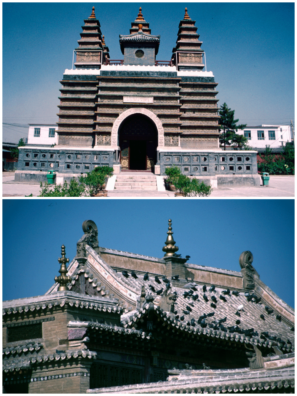
However, long-standing structures such as Dazhao Temple dating back to 1557 survived. In the late 17th century it was dedicated to Qing emperor Kangxi. Around the temple a settlement known as the "Blue Town" grew up, its name changing to Guihua in 1575. Merchants and traders gathered there including a Hui (Muslim) community that had settled north of the gate to the city's fortress, erecting their mosque in 1693. The city sat on a route that brought the Silk Road round by the Yellow river before striking across today's northern Shanxi and Hebei toward Beijing. A railway was pushed along that corridor reaching Hohhot in 1921, so reducing dependency on camel caravan connections.

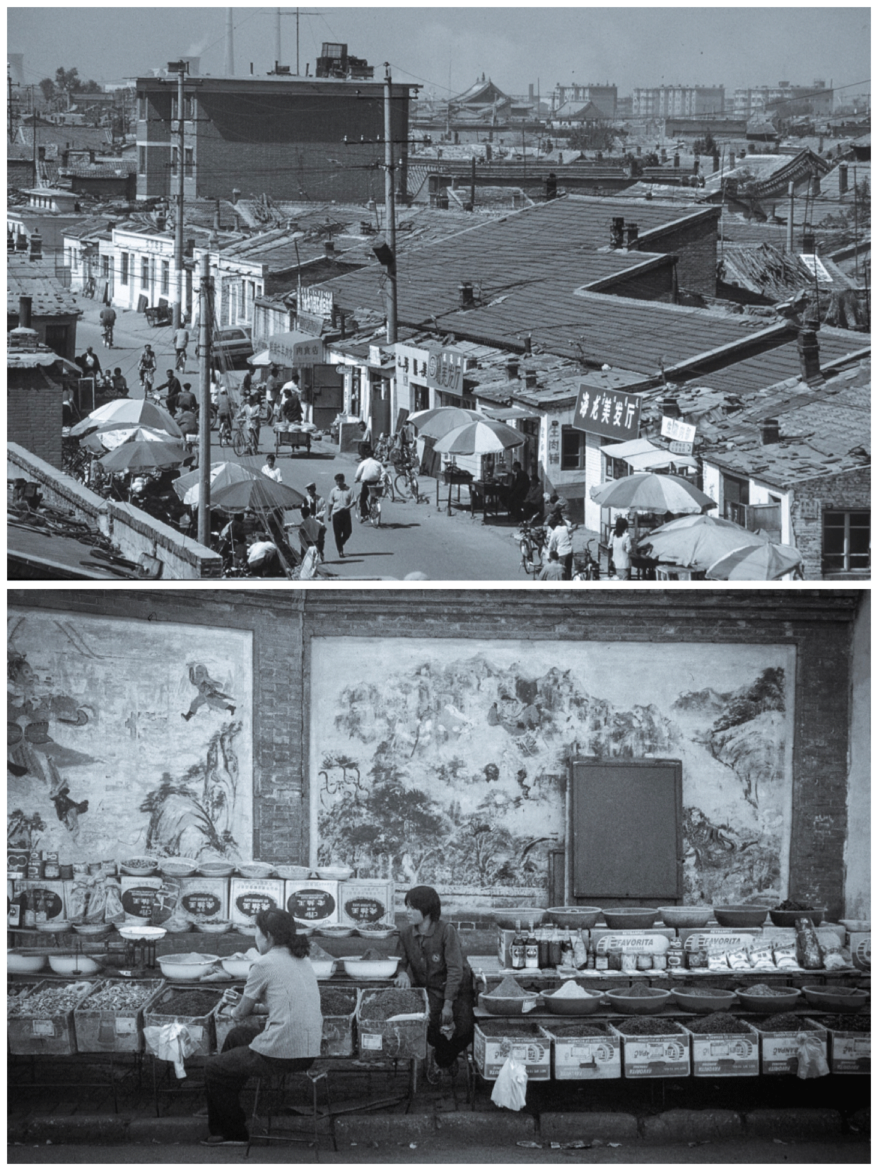
While the Dazhao Temple was a fascinating place to visit, I was intrigued by its surrounding area. There appeared a similarity to Beijing's historic hutong alleys that dated from the founding of 13th century Yuan Dadu, the "Great Capital" of Kubla Khan. There in older Hohhot I walked through areas of one-story buildings with gray tiled roofs and decorative square window frames. The lanes were vibrant with everyday life - noodle and meat stalls, spice sellers, clouds of steam rising from cooking pots heated over open stoves. Chatting locals sat at outdoor restaurant tables alongside piles of red and green peppers while children emerged from a local elementary school. Bicycles constantly streamed past.

I felt I had walked into a Hohhot of a bygone age, one that was filled with images travelers may have had when indeed the city was a major staging post on the routes to and from Central Asia. A time when hides, wool, spices and so much more were traded in the markets before onward shipment.
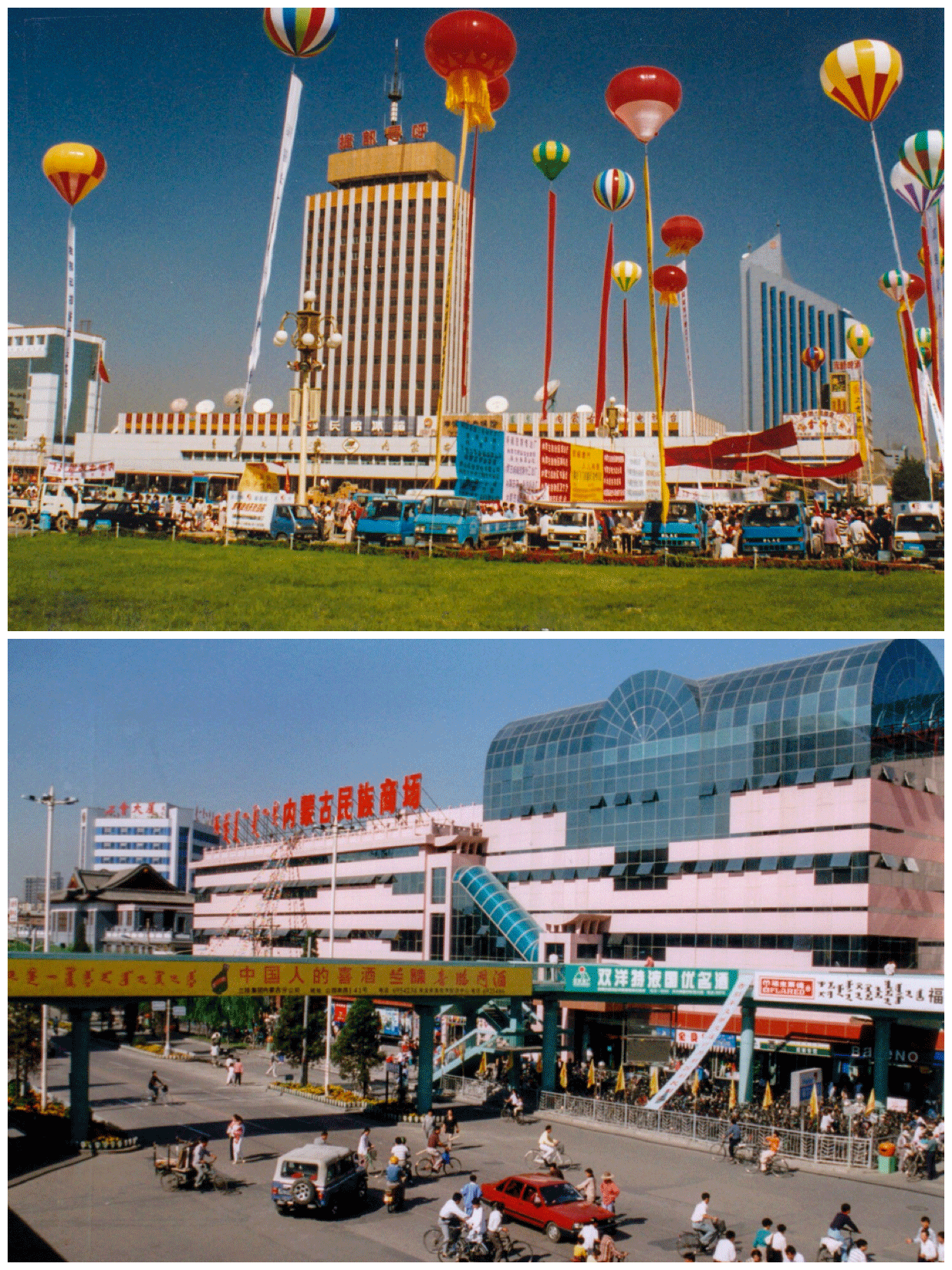
Returning in 2000 I could find no trace of that area I photographed three years previously. Although there remained the bicycle flow, Hohhot was expanding, roads widening, buildings rising higher, car numbers increasing - but all continuing under that intense blue sky. Visiting the then-recently opened shopping facilities, featuring international brands, along Zhongshan Road and around Xinhua Square, it was obvious the direction in which Hohhot was heading.
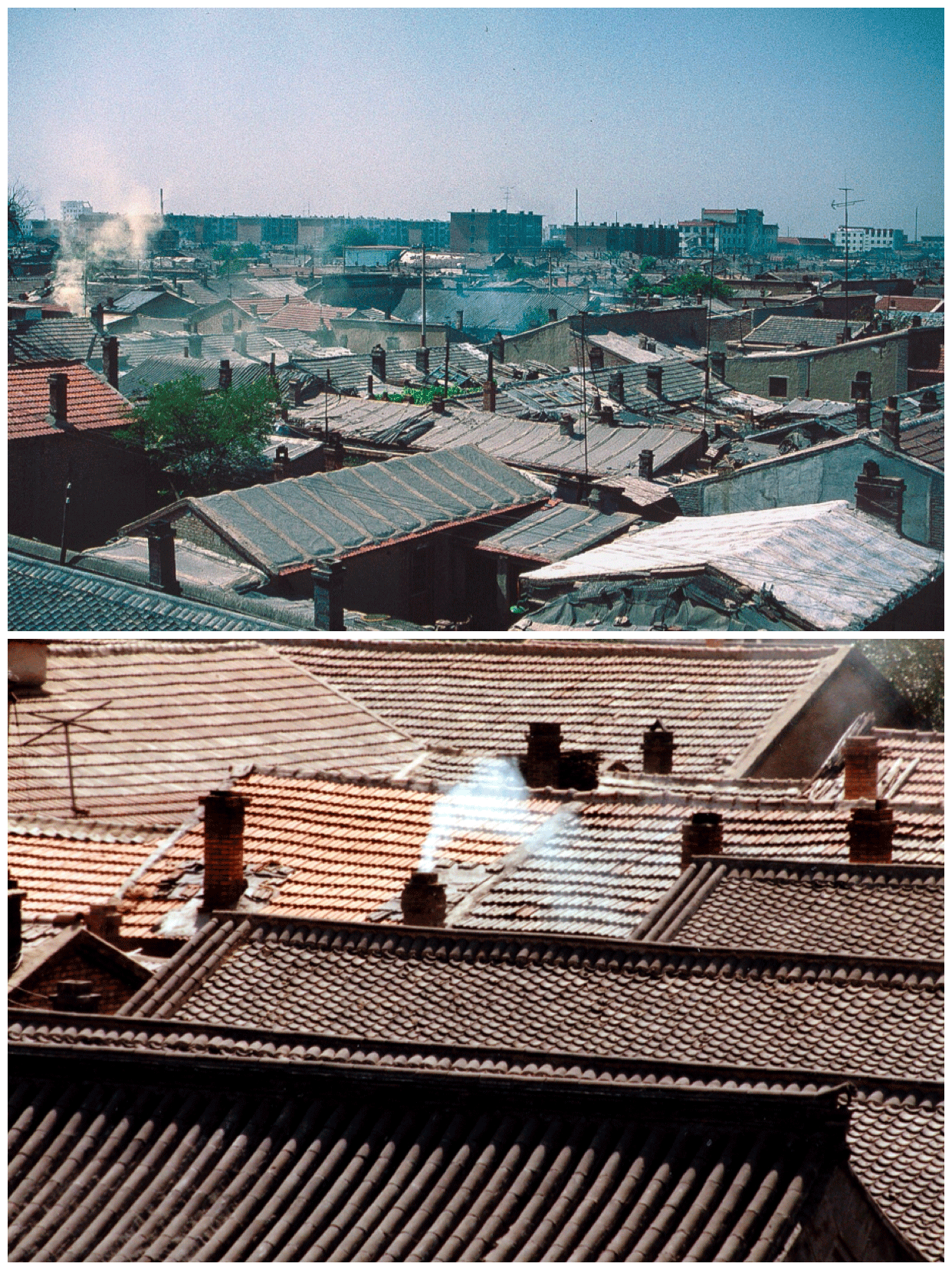
Another vantage point to look across both the older and newer skylines of Hohhot was the unique Wutasi or "Five Pagoda Temple". Part of former Ci Deng Temple it dated from 1727. Five small pagodas stood on a rectangular block of glazed bricks. 1563 tiny but individual Buddha figurines were carved into niches along its walls. Again, the personal fascination was to gaze from Wutasi across southwestern Hohhot. Once more a similarity to Beijing's hutongs, there was however a difference with distinctive brick chimneys rising from often flat roofs. In the distance I could pick out a large temple along with the minaret tower of a mosque. However, it was the scenes of constant movement of people, of everyday life in the alleys below that transfixed me, of a China I knew would change radically in the coming years. Looking back over the past 31 years I appreciate I have been fortunate to have experienced the country in various stages of its transition and be able to put much of what I saw into a contemporary perspective.

However, to understand more of both the city's history and indeed that of Inner Mongolia, a visit to the regional museum proved beneficial. Amusingly for many of the visitors that sunny morning, I felt I was the exhibit as even at that time, 1997, many locals possibly had never met a westerner! Inner Mongolia occupies a vast area of land taking in several different climatic zones. I was fascinated with the costumes, the lifestyle of the different ethnic groups ranging from dwellers of deserts and grasslands to bitterly cold northern forests. Totally unfamiliar musical instruments were on display alongside many illustrations of the summer Naadam Festival held annually on the grasslands. Equally fascinating was the paleontology section showing that dinosaurs and mammoths once roamed the region.
Visiting different parts of China provides opportunities to experience great regional cuisines. I would certainly appreciate that both in Hohhot and beyond. Everything from steaming, delicious bowls of vegetable and mutton stew to the lamb barbecues washed down with copious quantities of local fiery drinks accompanied by loud, boisterous singing from waiters serving the dishes.

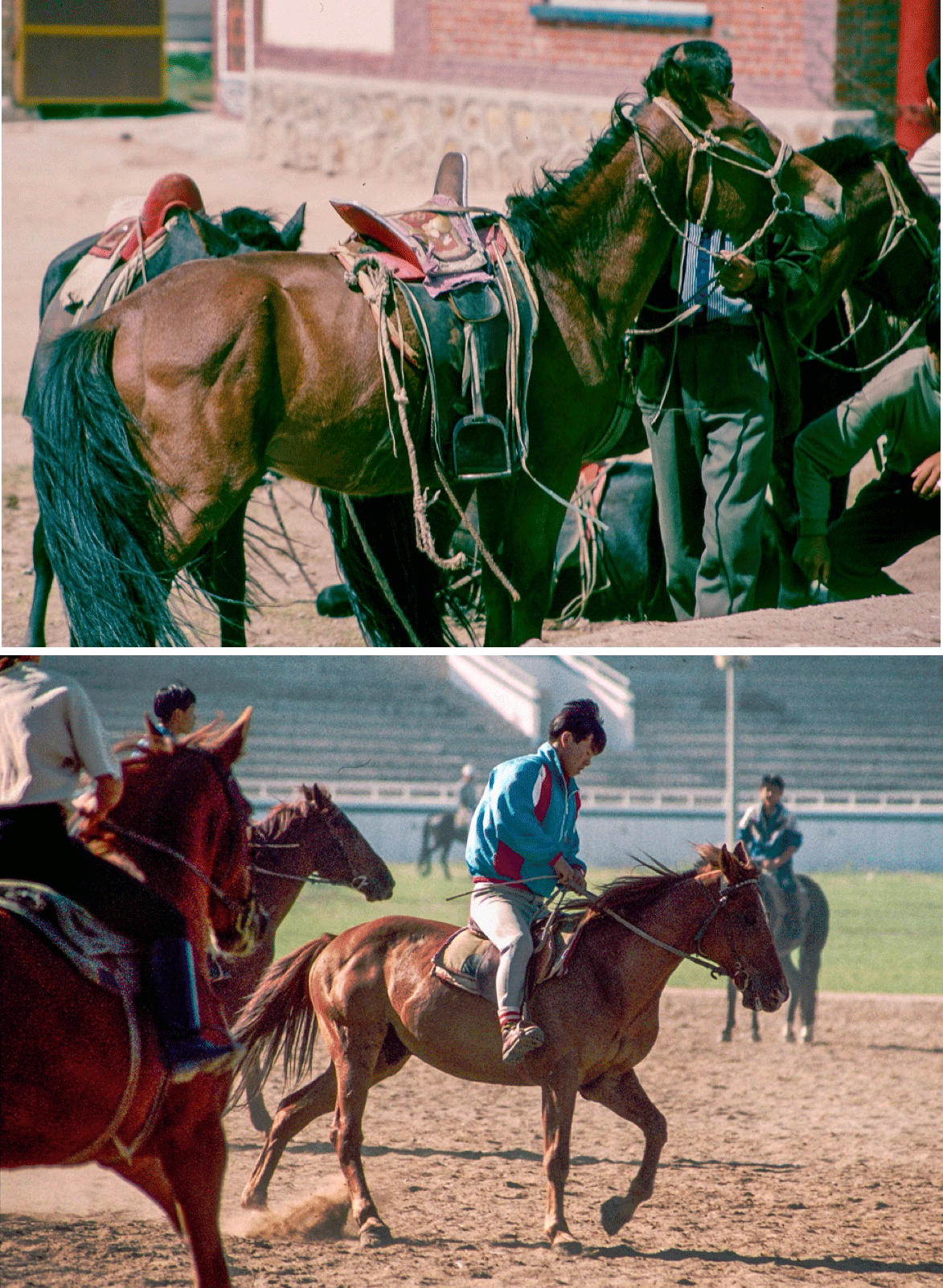
North beyond Hohhot were grasslands I wished to explore but before leaving the city I first went to a stadium where several jockeys were showing their horse riding skills. The horse is an important element within the culture of the peoples of the grasslands. At the sports ground I watched as young men and women put their steeds through various paces including galloping followed by slow circling. All beautiful to observe.
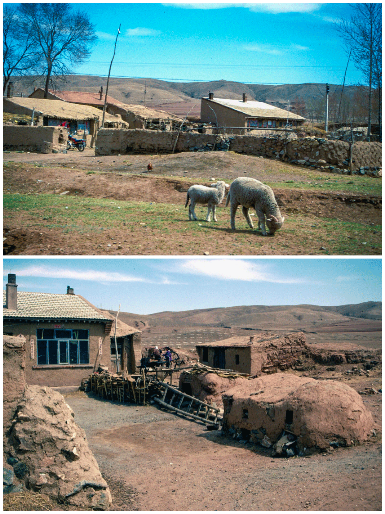
Twice I visited the area north of Hohhot, first to the Xilamuren Grasslands and three years later experiencing a much drier environment, feeling more like semi-desert. Looking at maps, directly north of the Great Bend the land is hilly allowing forestry and some farming but that quickly gives way to an increasingly dry, hostile landscape with virtually no human settlement. Indeed it is the Yellow River that provides for the scale of urbanism and economic activity today seen along the Hohhot-Baotou corridor.
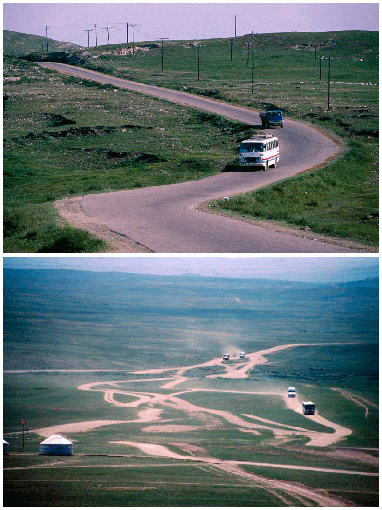
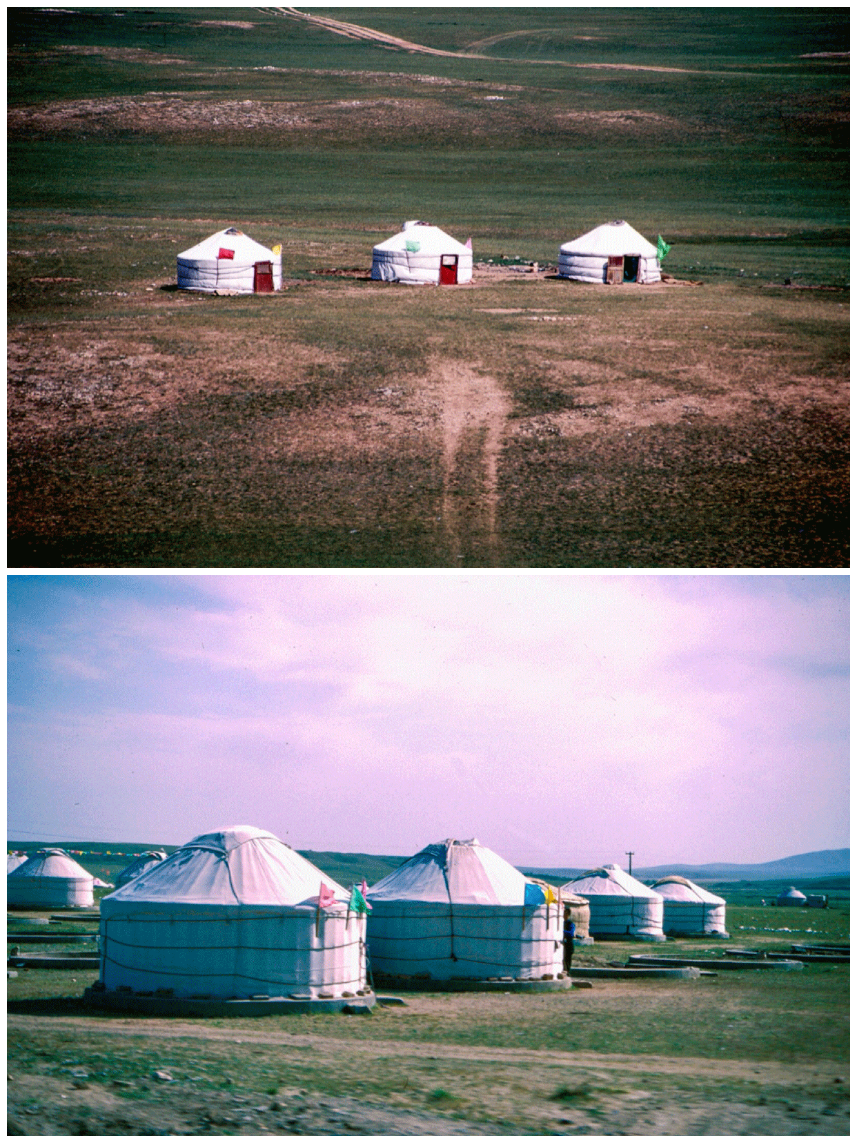
Leading off the main highway to Baotou, a road heads up a long valley initially well farmed while encompassing several villages. Gradually the land becomes drier, settlements fewer, trees disappeared as the grasslands are reached. Flocks of sheep grazed alongside groups of circular tents, or yurts, which were mainly there for tourists. Few people in that area were still following nomadic practices. Most lived in brick homes usually within villages although yurts regularly stood alongside the newer permanent dwellings.

Bee keepers looked after buzzing hives located where purple and blue flowers added color to the terrain. Shepherds on horseback rode alongside as the road leveled out onto a plateau encompassing a deep feeling of "Big Sky Country". A small town, Wulantuge, acted as gateway to the Xilamuren Grasslands. Groups of yurts again crowded the roadside with locals trying to entice visitors to stay. Even then, in 1997, tourism was seen as vital for the local economy. In one yurt I sampled milk tea, and "chao mi" or baked yellow rice mixed with butter and sugar. Walking around, I watched how people still would travel by horseback but for many younger people, the motorcycle had become the desired form of local transport.
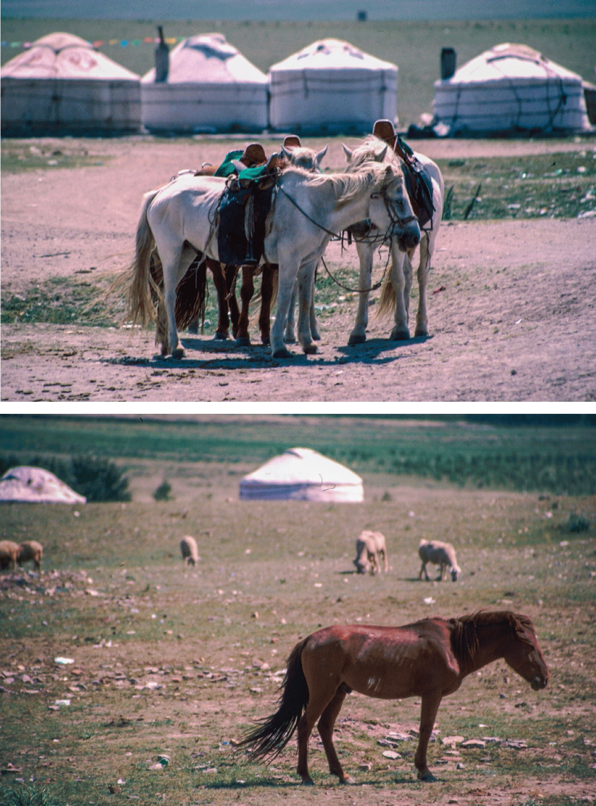
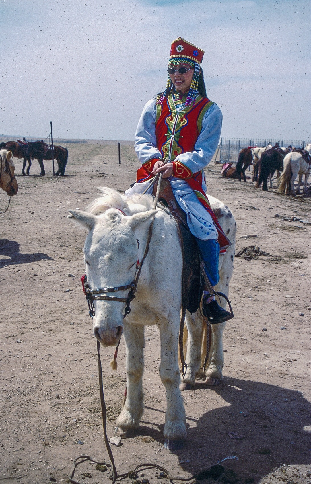
Beyond, the land rose gradually to a highpoint, Alebin Aobo Hill. An aobo, a large circular pile of stones, sometimes with clusters of shorok flags rising from the top. Such prominent landmarks acted both as directional markers for travelers and also where seasonal religious festivals and ceremonies would have taken place. Beyond I looked across grasslands crisscrossed by earthen tracks while dotted by white circular yurts. Horsemen tried to persuade visitors to experience riding their fine steeds adorned with traditionally decorated saddles. I preferred simply to look over the scene, of the grasslands.

Three years later with my geographical group, we visited a much drier area where farming appeared increasingly difficult. There I wondered how long people could live in such environments if they did not have tourism as an income. It was an experience to dine in a village restaurant looking outside at the horsemen, the traditional life while we, with large knives, cut off chunks of roast lamb from a much larger piece of meat on the table. However, the feeling I had was of people living "on the edge". There was always the threat of desertification but I did see several attempts at environmental stabilization to not only facilitate farming but also help alleviate the sandstorms that each spring could blow across northern China. Just looking at the maps and realizing the extent of the desert to the north, that task appeared challenging. I left the grasslands heading west to experience some of Inner Mongolia's stunning environments, the sand deserts.